

- Uttarakhand Tours
- Chandan_singh
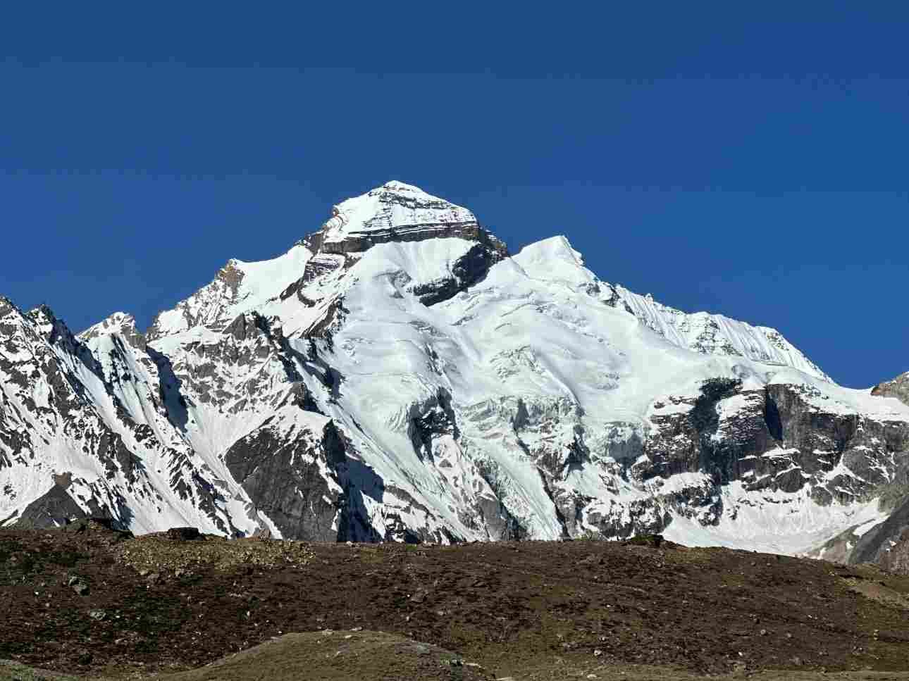
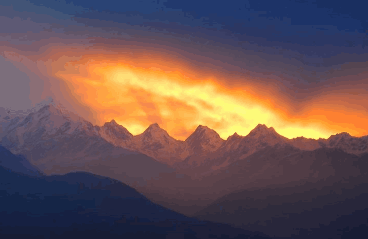
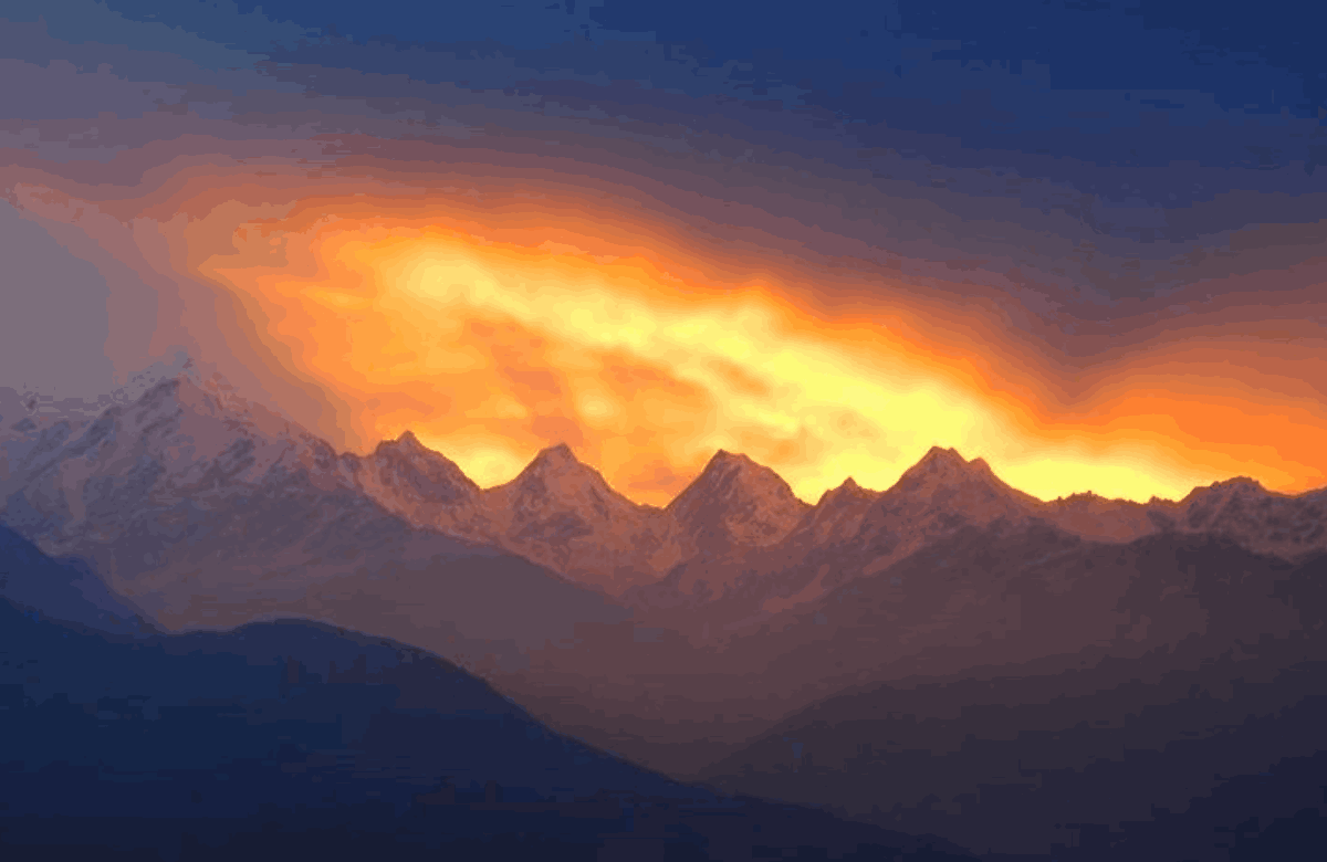
Imagine waking up at 4:30 AM, stepping onto a cold balcony, and looking towards the mountains. Sometimes, all you see is a blanket of clouds. But on a clear morning, the first rays of sunlight turn the magnificent Panchachuli Peaks golden, creating one of the most beautiful Himalayan sunrise experiences. Panchachuli is a group of five snow-covered mountain peaks in the Kumaon region of Uttarakhand. Located near Munsiyari in Pithoragarh district, these peaks attract travellers, photographers, trekkers and mountain lovers throughout the year. However, planning a Panchachuli sunrise trip requires more than setting an early alarm. You need to know the best viewpoints, sunrise and sunset timings, seasonal temperatures, trekking options, accommodation choices and permit requirements.
This complete guide covers everything you need to plan your Panchachuli trip, including the names and heights of the five peaks, the best places to watch sunrise and sunset, trekking routes, booking information and a suggested three-day itinerary.
Panchachuli at a Glance
| Detail | Information |
|---|---|
| Mountain Range | Panchachuli Peaks |
| Location | Near Munsiyari, Pithoragarh district, Uttarakhand |
| Number of Peaks | Five |
| Highest Peak | Panchachuli II |
| Highest Elevation | 6,904 metres |
| Base Town | Munsiyari |
| Approximate Town Elevation | 2,200 metres |
| Best Sunrise Viewpoints | Munsiyari town and Khaliya Top |
| Best Sunset Viewpoints | Khaliya Top and Betulidhar |
| Best Months to Visit | March to June and September to November |
| Winter Temperature | Can fall to around -5°C in Munsiyari |
| Main Trek Options | Khaliya Top and Panchachuli Base Camp |
| Permit Requirement | Inner Line Permit for the Darma Valley trek |
Quick Answer: Where Is the Best Place to See Panchachuli Sunrise?
The best place to see Panchachuli sunrise depends on your travel style and how much trekking you want to do.
For an easy sunrise: Choose a viewpoint in Munsiyari town or book accommodation facing the mountains.
For a wide mountain panorama: Trek to Khaliya Top, which sits at approximately 3,500 metres.
For sunset views: Consider Betulidhar or the summit of Khaliya Top.
For the best visibility: Plan your trip between March and June or September and November.
For a longer adventure: Consider the Panchachuli Base Camp trek in the Darma Valley.
For booking: There is no separate official sunrise ticket identified in the sources used for this guide. Visitors generally book accommodation, camping or guided trekking arrangements instead.
Actual visibility depends on weather, cloud cover and local mountain conditions.
Panchachuli Peaks: Names, Heights and the Pandava Legend
The Panchachuli Peaks are a group of five snow-covered summits at the eastern end of the Kumaon Himalayas in Uttarakhand. They are located near Munsiyari in Pithoragarh district and are numbered from northwest to southeast.
The word “Panchachuli” is commonly interpreted as “five hearths.” The mountains are famous for their dramatic appearance, snowy slopes and cultural significance.
Panchachuli Peaks Names and Heights
| Peak | Height | Important Information |
|---|---|---|
| Panchachuli I | 6,355 m | First-ascent details vary between sources. |
| Panchachuli II | 6,904 m | The highest peak of the group; first climbed on 26 May 1973 by an Indo-Tibetan Border Police team led by Mahendra Singh. |
| Panchachuli III | 6,312 m | Listed as unclimbed by Wikipedia in the source material. |
| Panchachuli IV | 6,334 m | First-ascent details vary between sources. |
| Panchachuli V | 6,437 m | First climbed on 20 June 1992 by Stephen Venables, Victor Saunders, Stephen Sustad and Dick Renshaw during an Indo-British expedition. |
Peak elevations and climbing records should be treated as approximate where published sources disagree.
Where Are the Panchachuli Peaks Located?
The Panchachuli massif lies in the eastern Kumaon region of Uttarakhand, near the Darma Valley and the Gori Ganga Valley.
The mountain group forms part of the watershed between these valleys. Dugtu village is located near the massif, while Munsiyari serves as the usual motorable base for travellers who want to see the peaks.
Munsiyari is popular because visitors can enjoy mountain views without undertaking a demanding expedition.
The Legend Behind the Name Panchachuli
According to local belief, the five peaks are associated with the five Pandava brothers from the Mahabharata: Yudhishthira, Bhima, Arjuna, Nakula and Sahadeva.
The legend says that the brothers used the five mountain hearths to cook their final meal before ascending towards heaven.
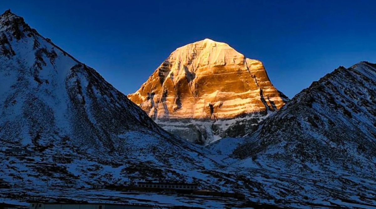
The golden glow that appears on the peaks around sunrise and sunset adds to their spiritual appeal. For many travellers, watching the first light reach these mountains is one of the highlights of visiting Munsiyari.
Glaciers Beneath the Panchachuli Peaks
Several glaciers lie around the Panchachuli mountain group. These include Uttari Balati, Dakshini Balati, Duktu, Sona and Meola glaciers.
The Panchachuli Base Camp trek in the Darma Valley takes trekkers towards the foot of the mountain group and the surrounding glacial landscape.
Best Panchachuli View Points Near Munsiyari
You do not need to complete a long trek to see the Panchachuli Peaks. Several viewpoints around Munsiyari provide impressive mountain views, making the region suitable for families, photographers and adventure travellers.
The best viewpoint depends on whether you prefer an easy sunrise, a short walk, a lake surrounded by meadows or a high-altitude panorama.
Panchachuli Viewpoints Compared
| Viewpoint | Distance or Effort | Best For |
|---|---|---|
| Munsiyari town | No major hike required | Easy sunrise and mountain views |
| KMVN Panchachuli Tourist Rest House | Located in town | Watching sunrise from your room or balcony |
| Nanda Devi View Point and Temple | Approximately 3 km trek from the road to the temple | Early-morning mountain views |
| Balanti Potato Farm | Approximately 2 km trek | A short walk with mountain views |
| Maheshwari Kund | Around 30 minutes to an hour on foot | A peaceful clearing and mountain scenery |
| Betulidhar | Approximately 5 km from town | Sunset over the Johar Valley |
| Thamri Kund | Around 10 km from town, including a 3 km nature trail | A lake surrounded by alpine meadows |
| Khaliya Top | Approximately 6 km climb; around 3,500 m elevation | Panoramic mountain views, sunrise and sunset |
Distances and route descriptions vary across travel sources. Confirm the latest trail conditions and directions locally before setting out.
Munsiyari Town: The Easiest Sunrise Viewpoint
Munsiyari is one of the most convenient places to see the Panchachuli Peaks. The mountains can be viewed from several locations around town, including the Munsiyari–Thal road, ITBP grounds and the GMVN ridge. You can enjoy the scenery without undertaking a difficult trek. Some hotels and guesthouses also offer rooms or balconies facing the mountains. For travellers who prefer comfort, booking a room with a direct mountain view is an excellent option. You can wake up before sunrise, enjoy a warm drink and watch the peaks change colour as the morning light reaches them.
KMVN Panchachuli Tourist Rest House
The KMVN Panchachuli Tourist Rest House is a useful accommodation option for visitors who want to enjoy the mountain views from their stay. The property is known for overlooking the Panchachuli range, and some rooms have large windows or balconies facing the mountains. If sunrise is the main purpose of your trip, request a room facing the peaks and confirm the view with the property before completing your booking.
Khaliya Top: The Best Panoramic Viewpoint
Khaliya Top is one of the most popular viewpoints near Munsiyari. Located at approximately 3,500 metres, it offers a broad panorama of the surrounding Himalayan mountains. From the top, visitors may see Panchachuli along with Nanda Kot, Nanda Devi, Rajrambha and Hardeol, depending on visibility. The trek is commonly described as easy to moderate, although weather, altitude, fitness and trail conditions can affect the difficulty.
Tips for visiting Khaliya Top:
Allow sufficient time for the climb.
Consider staying overnight at the base camp if you want to watch sunrise from the top.
Carry warm clothing because temperatures can drop sharply before dawn.
Check the forecast before starting.
Seek local guidance if there is snow or ice on the route.
Khaliya Top is a particularly good option for photographers and travellers who want more than a view from town.
Betulidhar: A Beautiful Sunset Spot
Betulidhar is located approximately 5 km from Munsiyari and is known for evening views over the Johar Valley and the Gori River canyon. It can be a convenient stop after exploring Munsiyari during the day. Arrive before sunset so you have enough time to find a suitable viewpoint and enjoy the changing colours of the mountains.
Thamri Kund and Maheshwari Kund
Thamri Kund and Maheshwari Kund are scenic destinations surrounded by natural landscapes. Thamri Kund is reached by a nature trail through alpine meadow country. On clear days, the surrounding scenery and reflections can make it attractive for photography. Maheshwari Kund is closer to town and offers a peaceful clearing with mountain views. These places are worth considering if you want to combine your sunrise experience with short nature walks.
Panchachuli Sunrise and Sunset Timings Through the Year
Sunrise and sunset times change throughout the year. If you want to watch the Panchachuli Peaks glow in the early morning, plan your departure according to the date of your visit. The sunrise and sunset figures below are approximate astronomical times for Munsiyari. The moment direct sunlight reaches the peaks can differ because of the surrounding mountains.
Approximate Sunrise and Sunset by Season
| Period | Sunrise | Sunset | Travel Considerations |
|---|---|---|---|
| Mid-January | Around 6:59 AM | Around 5:18 PM | Very cold mornings |
| Mid-February | Around 6:40 AM | Around 5:43 PM | Cold weather continues |
| Mid-March | Around 6:15 AM | Around 6:00 PM | Longer days begin |
| Mid-April | Around 5:45 AM | Around 6:20 PM | Good period for outdoor activities |
| Mid-May | Around 5:15 AM | Around 6:45 PM | Early starts are necessary |
| Mid-June | Around 4:59 AM | Around 7:00 PM | Very early sunrise and long daylight |
| Mid-July | Around 5:05 AM | Around 7:19 PM | Monsoon clouds may obstruct views |
| Mid-August | Around 5:25 AM | Around 6:55 PM | Weather conditions vary |
| Mid-September | Around 5:45 AM | Around 6:20 PM | Clearer conditions may return |
| Mid-October | Around 6:05 AM | Around 5:42 PM | Often a good period for mountain visibility |
| Mid-November | Around 6:30 AM | Around 5:25 PM | Cold mornings |
| Mid-December | Around 6:50 AM | Around 5:18 PM | Winter conditions and possible snow |
These values are approximate and should not replace date-specific sunrise and sunset information. The original source calculation uses the 15th of each month and is checked against published October 2026 timings.
Panchachuli Sunrise Timing in October
For October 2026, the published Munsiyari figures in the source material show:
1 October: Sunrise around 5:54 AM and sunset around 6:02 PM.
19 October: Sunrise around 6:05 AM and sunset around 5:42 PM.
31 October: Sunrise around 6:14 AM and sunset around 5:30 PM.
These times are specific to the stated dates and should not be treated as fixed annual timings.
How Early Should You Arrive?
For a relaxed sunrise experience, try to reach your viewpoint approximately 30–45 minutes before the listed sunrise time. This gives you time to settle in, prepare your camera and watch the sky brighten before the sun appears. After sunrise, stay another 20–30 minutes if conditions allow. The colour on the snow-covered peaks can continue changing after the first light. For sunset, arrive approximately 30 minutes early and remain until the final glow fades.
Important: The time the sun rises above the horizon is not necessarily the exact time direct sunlight reaches the Panchachuli summits. The surrounding mountain terrain affects the timing.
Panchachuli Temperature by Season
Munsiyari experiences cool weather throughout the year, with particularly cold mornings and freezing winter nights.
The temperature at higher locations such as Khaliya Top and the Darma Valley base camps can be lower than in Munsiyari town.
Published travel sources provide slightly different temperature ranges. The figures below are approximate and should be used as general planning guidance.
Panchachuli Temperature by Season
| Season | Approximate Temperature or Conditions | What to Expect |
|---|---|---|
| Spring: March–April | Temperatures vary; approximately 10–25°C is reported for the broader March–June period by one source | Pleasant daytime conditions and spring flowers |
| Summer: May–June | Reported ranges vary from approximately 0–20°C to 10–25°C | Generally favourable travel conditions, but mornings can be cold |
| Monsoon: July–September | Approximately 8–20°C in published town-level ranges | Clouds, rain and possible road disruption |
| Autumn: October–November | One source reports around 15–20°C for autumn | Crisp air and potentially clear mountain views |
| Winter: December–February | Nights can reach approximately -5°C; published ranges vary | Freezing mornings and possible snowfall |
These figures refer mainly to Munsiyari town. Higher trekking locations can be significantly colder, particularly at night.
Month-by-Month Temperature Examples
One source lists the following approximate high and low temperatures for Munsiyari:
| Month | Approximate High | Approximate Low |
|---|---|---|
| May | 18°C | 6°C |
| June | 20°C | 10°C |
| July | 18°C | 9°C |
| August | 17°C | 8°C |
| September | 17°C | 7°C |
| December | 5°C | -5°C |
| January | 5°C | -5°C |
| February | 7°C | -4°C |
These are reported figures rather than a guarantee of actual conditions during your trip.
When Does It Snow in Munsiyari?
Snowfall is generally associated with the winter months. The source material identifies December, January and February as snowfall months, while another travel source notes that snow can begin around late November or December and continue into early March. Winter can offer beautiful mountain scenery on clear days, but snow and ice may make higher trails more difficult. If you plan to trek to Khaliya Top during winter, assess your experience and seek local guidance before setting out.
What Should You Pack for a Panchachuli Sunrise?
Even if daytime temperatures are comfortable, the pre-dawn wait can feel very cold.
Pack the following essentials:
A warm jacket and thermal layers.
Gloves and a woollen cap.
Comfortable walking or trekking shoes.
A waterproof layer during the monsoon and changeable seasons.
A headlamp for early-morning walks.
A camera, spare batteries and a power bank.
Drinking water and suitable snacks.
For higher-altitude treks, check the specific equipment requirements with your trekking operator.
Panchachuli Trek Options: Khaliya Top, Base Camp and Glacier Routes
Travellers have several trekking options in the Munsiyari and Darma Valley region. The best choice depends on your available time, fitness, experience and interest in high-altitude scenery.
Khaliya Top is the shorter option, while the Panchachuli Base Camp trek takes you deeper into the Darma Valley.
Panchachuli Trek Options Compared
| Trek | Approximate Duration | Difficulty | Permit Information | Main Attraction |
|---|---|---|---|---|
| Khaliya Top | One or two days; approximately 12 km round trip | Easy to moderate | A forest entry fee is reported; verify current rules | Panoramic mountain views |
| Panchachuli Base Camp, Darma Valley | Around 5–7 trekking days; one itinerary covers 11 days from Delhi | Moderate in one itinerary, with difficult trail sections | Inner Line Permit required | Close views of the Panchachuli range and glacier |
| Milam Glacier | Approximately 9–10 days | Depends on route and conditions | Inner Line Permit required | Glacier and high Himalayan scenery |
| Ralam Glacier | Approximately 8 days | Not consistently rated in the sources | Inner Line Permit required | Remote mountain scenery |
| Namik Glacier | Approximately 10 days | Not consistently rated in the sources | Inner Line Permit required | Glacier and valley landscapes |
Durations vary by itinerary, starting point, weather and acclimatisation requirements. Confirm the exact plan with your operator.
Khaliya Top Trek
Khaliya Top is a popular trekking destination for visitors staying in Munsiyari. One guide describes a route of approximately 6 km each way from Khaliya Dwar, with a clearly marked trail. Another account describes a route starting near Balati Bend. The precise starting point and route distance therefore need to be confirmed locally. The trek is often considered easy to moderate, but steep sections, altitude, rain or snow can increase the difficulty.
Reported Khaliya Top Trek Costs
| Expense | Reported Cost |
|---|---|
| Forest entry | ₹50 per person |
| Parking for a bike | ₹50 |
| Parking for a car | ₹100 |
| Base camp tent stay | Approximately ₹1,000 per person |
| Guide | Additional charge |
These are figures reported by a travel guide, not confirmed current rates. Verify all fees and accommodation costs before travelling.
Best Season for Khaliya Top
Spring can bring rhododendron blooms, while May and June often offer longer daylight hours. September and October are also attractive for crisp air and mountain views. Winter snow can make the trek more challenging. Travellers without suitable experience should seek local advice and avoid attempting unsafe conditions.
Panchachuli Base Camp Trek in the Darma Valley
The Panchachuli Base Camp trek is a longer adventure for travellers who want to explore the mountain region more closely. The route described in the source material runs from Dharchula through Dar, Sela, Nagling, Baling and Duktu towards the base camp, following the Dhauliganga River. One itinerary covers approximately 60 km of trekking over seven trekking days within an 11-day trip from Delhi. Another trekker completed the route in five days, although the trail includes demanding sections.
Important Trekking Considerations
Altitude: Published base camp elevations differ substantially. Confirm the planned altitude with your trekking operator.
Trail conditions: Some sections are narrow and exposed, with steep drops near the river or cliffs.
Weather: Rain, landslides and snow can affect access and safety.
Duration: Allow sufficient time for travel, acclimatisation and unexpected delays.
Permits: Arrange the required Inner Line Permit before entering the restricted area.
The source material identifies April to June and September to early November as suitable planning periods. It warns against attempting the trek during the July–August monsoon and during winter snow conditions.
Inner Line Permit for the Darma Valley
The source guide describes the following process for the Darma Valley trek:
Contact the Sub-Divisional Magistrate (SDM) office in Dharchula.
Apply in writing for the Inner Line Permit.
Prepare a passport-size photograph and a copy of government identification.
State the full duration of your trip.
Register the permit at the ITBP camps in Sela and Baling, as instructed.
Permit procedures, documentation and fees can change. Confirm current requirements with the relevant administration office and your trekking operator before departure.
Glacier Treks from Munsiyari
Other trekking routes in the wider region include Milam, Ralam and Namik glaciers.
One travel guide gives the Milam trek a duration of approximately 9–10 days and a round-trip distance of around 90–95 km. Ralam is described as an approximately eight-day trek, while Namik is around ten days.
These are longer mountain journeys that require appropriate planning, permits, supplies and an assessment of current conditions.
Panchachuli Sunrise Booking: Hotels, Camps and Permits
There is an important distinction between booking a sunrise ticket and booking a place from which to watch the sunrise.
The source material does not identify a separate official Panchachuli sunrise ticket. The mountains can be viewed from accessible viewpoints, while visitors may need to arrange accommodation, camping or a guided trek depending on their plans.
What Can You Book for a Panchachuli Sunrise?
| Option | How to Arrange It | Important Details |
|---|---|---|
| KMVN Panchachuli Tourist Rest House | Book directly through KMVN | Request a room facing the mountain range |
| Hotels, resorts and homestays | Contact the property or use a booking platform | Confirm the view, dates and cancellation terms |
| Khaliya Top base camp tent | Arrange locally at the base camp | Reported prices are approximate and negotiable |
| Darma Valley trek | Book with a suitable trekking operator | Confirm the itinerary and Inner Line Permit requirements |
Booking the KMVN Panchachuli Tourist Rest House
The KMVN Panchachuli Tourist Rest House is a useful option for travellers who want to watch sunrise without trekking to a high-altitude viewpoint.
The source material lists the following accommodation information:
Booking: Through KMVN's official booking channels.
Location: Munsiyari, Uttarakhand.
Rooms listed: Two super deluxe family suites, two executive bedrooms, two royal double rooms and a 16-bed dormitory.
Payment: The cited listing specifies 100% advance payment.
Check-in: 1:00 PM.
Check-out: 11:00 AM.
Additional bed: The cited listing reports ₹200 per day.
Extra person: The cited listing reports an additional charge of 20% of the room rent for a person over five years old.
The source material does not provide a reliable current room-rate list. Confirm the room category, price, mountain-facing view and all booking conditions directly with KMVN before making payment.
Cancellation and Refund Information
The cited accommodation listing reports the following cancellation terms:
| Cancellation Timing | Reported Refund |
|---|---|
| 15 or more days before check-in | 90% |
| 10–14 days before check-in | 75% |
| 5–9 days before check-in | 50% |
| Fewer than 5 days before check-in | No refund |
These are terms reported in the source material and may have changed. Check the current policy on the official booking channel before confirming your reservation.
How to Reach Munsiyari for the Panchachuli View
Munsiyari is the main base for travellers who want to see the Panchachuli Peaks. Reaching it generally involves a train or flight followed by a long road journey.
The exact travel distance depends on your starting point and route. Allow adequate time for mountain roads and changing weather conditions.
Distances to Munsiyari
| Starting Point | Approximate Distance or Travel Information |
|---|---|
| Delhi | Approximately 560–578 km by road |
| Kathgodam Railway Station | Approximately 278 km |
| Haldwani | Around 9–10 hours by taxi, according to one source |
| Pithoragarh | Approximately 128 km in one listing; other figures differ |
| Pantnagar Airport | Published distances vary considerably, approximately 188–315 km |
| Chaukori | Approximately 98 km |
These figures are approximate and come from different travel sources. Check your route and travel time before departure.
How to Reach Munsiyari by Train
Kathgodam is the nearest major railway station commonly used for travel to Munsiyari.
A typical journey involves:
Taking a train to Kathgodam.
Arranging a taxi or other road transport.
Continuing to Munsiyari through the mountain roads.
One source also reports a morning bus from Haldwani at approximately 6:30 AM, with a fare of around ₹400–₹500. Bus schedules and fares may change, so verify the current service before relying on it.
How to Reach Munsiyari by Air
Pantnagar is the airport commonly associated with travel to this region. From there, you need to continue by road. Published distance estimates vary, so check the exact route and driving time with your transport provider before finalising your itinerary.
How to Reach Munsiyari by Road
Munsiyari can be reached by road from Delhi and other towns in Uttarakhand. The drive from Delhi is approximately 560 km or more, depending on the route. Private taxis and jeeps are useful for local travel, particularly if you want to visit multiple viewpoints. Public transport may be limited for some local routes. If you plan to visit Khaliya Top, Betulidhar or other viewpoints, ask your accommodation about current road access and local transport options.
Reaching the Panchachuli Base Camp Trek Starting Point
The Panchachuli Base Camp trek in the Darma Valley typically starts from the Dharchula area rather than Munsiyari. One itinerary describes travelling from Almora to Dharchula, followed by a drive of approximately 30 km to Sobla before beginning the trek. Confirm the exact meeting point, road access and permit arrangements with your trekking operator.
Best Time to See Panchachuli
The best time to visit Panchachuli depends on your priorities. Some travellers want clear mountain views, while others prefer spring flowers, summer trekking or snowy winter landscapes. The source material identifies March to June and September to November as the main recommended periods. Autumn receives particular praise for clear views of the snowy peaks.
Best Season to Visit Panchachuli
| Season | Mountain Views | Travel Considerations |
|---|---|---|
| March to June | Generally favourable, although conditions vary | Mild daytime weather and spring flowers; some rain risk in May and June |
| July to August | Often unreliable because of clouds | Monsoon rain and possible landslides |
| September to November | Often among the best periods for clear views | Crisp air, cold mornings and good trekking conditions |
| December to February | Beautiful views may be possible on clear days | Freezing nights, possible snow and more difficult high-altitude trails |
March to June: Spring and Early Summer
Spring and early summer can be good for exploring Munsiyari and surrounding viewpoints. Rhododendron blooms may appear around Khaliya Top in spring, while longer daylight hours make outdoor activities easier to plan. May and June can bring some rain, so check the forecast before starting a trek.
July to August: Monsoon Season
The monsoon can make Panchachuli views unpredictable. Clouds may hide the peaks for days, and heavy rain can affect mountain roads. Landslides and trail conditions are additional concerns. If you travel during this period, maintain flexibility and avoid trekking when conditions are unsafe.
September to November: Clear Mountain Views
Autumn is one of the strongest choices for travellers whose main goal is to see the Panchachuli Peaks clearly. The air can be crisp, and the snowy summits may stand out beautifully against clear skies. This period is also identified in the source material as suitable for planning the Darma Valley trek, subject to current conditions.
Book accommodation in advance and prepare for cold early mornings.
December to February: Winter Scenery
Winter offers the possibility of snowy landscapes and dramatic mountain views on clear days. However, temperatures in Munsiyari can fall to around -5°C, and higher trails can be much colder. Snow may make the Khaliya Top trek more difficult. Travellers should check local conditions and seek experienced guidance before attempting winter routes.
Practical Tips for Panchachuli Sunrise and Photography
A little preparation can make your sunrise experience more comfortable and improve your chances of enjoying clear mountain views.
Travel and Trekking Tips
Start early: Reach your viewpoint before sunrise rather than arriving after the first light.
Check the weather: Mountain conditions can change quickly, and clouds may obscure the peaks.
Carry warm layers: Dawn temperatures can be low even during warmer months.
Arrange permits in advance: Confirm requirements before entering the Darma Valley or other restricted areas.
Carry identification: Government identification may be required for accommodation or permit procedures.
Plan winter treks carefully: Snow can make routes more difficult. Seek local advice before setting out.
Carry food when necessary: Some routes may have limited food availability, particularly in winter.
Allow extra travel time: Mountain roads and weather can disrupt schedules.
Respect local guidance: Ask your host or a qualified local guide about current trail conditions.
Photography Tips for Panchachuli Sunrise
If photography is a priority, prepare your equipment before the sky begins to brighten.
Arrive before first light. This gives you time to choose your composition and set up your camera.
Use a tripod. A tripod can help with low-light photographs of the glowing peaks.
Carry spare batteries. Cold weather can reduce battery performance.
Keep batteries warm. Store spare batteries in an inside pocket when practical.
Photograph changing light. Try capturing the same scene before sunrise, after sunrise and later in the day.
Dress warmly while waiting. Standing still in the cold can feel uncomfortable even when the trek itself is manageable.
Respect the Mountains
The Panchachuli Peaks hold cultural and spiritual significance for local people. Keep trails clean, carry your waste back with you and avoid disturbing other visitors who have come to enjoy the quiet of the mountains.
Final Thoughts: Plan Your Panchachuli Sunrise
Panchachuli offers a memorable combination of Himalayan scenery, cultural stories, mountain viewpoints and trekking opportunities. For an easy experience, stay in Munsiyari and choose a viewpoint or accommodation facing the peaks. For a wider panorama, consider Khaliya Top, provided the weather and trail conditions are suitable. If you have more time and trekking experience, the Panchachuli Base Camp trek offers a deeper exploration of the surrounding mountain landscape. Choose your travel season carefully, check sunrise timings for your exact dates and pack for cold early mornings. Book accommodation in advance and arrange permits before entering the Darma Valley.
The Panchachuli Peaks are more than a beautiful mountain backdrop. Their association with local traditions and the Pandava legend adds another dimension to the experience. Watching the first rays of sunlight turn the summits golden is a memorable reason to visit Munsiyari.