

- Mount Kailash Blogs
- @Nagarjuna_Travels
Most people who search for Lipulekh Pass want one of two things: either they are pilgrims planning the Kailash Mansarovar Yatra through Uttarakhand, or they are trying to understand why this remote Himalayan pass keeps appearing in India-Nepal diplomatic headlines. What almost nobody finds is a single, complete guide that answers both questions — the geography, the altitude, the spiritual significance, the route, the history, and the geopolitical context — all in one place. This guide does exactly that. Whether you are a pilgrim planning to cross Lipulekh on your way to Mount Kailash, a trekker drawn by the high-altitude challenge, or a reader trying to understand why a 17,000-foot mountain pass keeps making front-page news — here is the complete, honest picture.
2026 Update: On April 30, 2026, India announced the resumption of Kailash Mansarovar Yatra via Lipulekh Pass (June–August 2026, 500 Indian pilgrims in batches of 50). Nepal formally objected on May 3, 2026, asserting territorial claim. India firmly rejected the objection, calling Lipulekh "a longstanding route used since 1954." The Yatra is proceeding as planned.
What Is Lipulekh Pass? Location, Altitude, and Basic Facts
Lipulekh Pass — also transliterated as Lipu Lekh or Lipulekh La, and known in Chinese as Qiang La — is a high-altitude Himalayan pass located in the Pithoragarh district of Uttarakhand, in India's Kumaon region. It sits at the intersection of three international borders: India to the south and west, China (Tibet Autonomous Region) to the north and east, and Nepal to the west. This makes Lipulekh one of a small number of trijunction border points on earth.
| Location | Detail |
| State | Uttarakhand, India (Pithoragarh district, Dharchula sub-division) |
| Altitude | ~5,115 to 5,334 metres (16,780 to 17,500 feet) |
| Mountain Range | Kumaon Himalayas (Greater Himalayan range) |
| Border | India-Tibet (China) border; near India-Nepal-China trijunction |
| Connects | Vyas Valley (India) to Purang / Taklakot (Tibet, China) |
| Distance to Kailash | ~97 km north of Mount Kailash |
| Season open | May to September annually |
| Road access | Yes — BRO Dharchula–Lipulekh high (80 km), inaugurated May 2020 |
| Chinese name | Qiang Laway |
The pass is described as a narrow gap in the Himalayan ridge line — a natural break in the mountains that has served as a crossing point between the Indian subcontinent and the Tibetan plateau for centuries. It is the lowest point in this section of the high Himalayas, which is precisely why it has been chosen as a crossing point for trade, pilgrimage, and now road infrastructure.
Lipulekh Pass Altitude: What the Height Means for Pilgrims and Trekkers
The Lipulekh pass altitude is the defining physical characteristic that shapes everything about the crossing — the climate, the accessibility, the health risks, and the challenge of building infrastructure here. Different sources cite slightly different altitude figures for Lipulekh Pass — ranging from approximately 5,115 metres (16,780 feet) to 5,334 metres (17,500 feet). This variation is typical of high passes where the exact measurement point and methodology affect the result. For practical planning purposes, treat the Lipulekh pass altitude as approximately 5,200 metres (17,060 feet) — between the two extremes cited.
What 5,200 Metres Actually Feels Like
- At 5,200 metres, the air contains roughly 53 percent of the oxygen available at sea level — well into the zone where altitude sickness is a genuine risk for most people
- The pass is higher than Everest Base Camp on the Nepal side (5,364 m) — placing it firmly in the extreme altitude category
- For pilgrims, this means Lipulekh is not a casual road stop — even arriving by vehicle, the body requires acclimatisation at lower altitudes (Gunji, Nabhidhang) before crossing
- Temperatures at the pass drop sharply even in summer — snow, ice, and high winds are possible on any given day between May and September
- The final 600-metre approach to the pass on the Indian side is too steep for road vehicles — mules and pack animals have traditionally been used for this section
The Route from Dharchula to Lipulekh Pass
For pilgrims and travellers approaching Lipulekh Pass from India, the journey begins at Dharchula — the last major town in Pithoragarh district, sitting at approximately 940 metres above sea level. The route from Dharchula to Lipulekh covers approximately 80 km of road and rises over 4,200 metres in altitude. This is the same route used for the Kailash Mansarovar Yatra via the Lipulekh Pass — and also serves as the Adi Kailash and Om Parvat yatra route for much of its length.
| Stage | Location | Altitude | Key Feature |
| Start | Dharchula | ~940 m | Last major town; ILP issuance; base for yatra |
| Stop 1 | Tawaghat / Malpa | ~1,100 m | River confluence; road gets rougher here |
| Stop 2 | Budhi | ~1,800 m | ITBP checkpoint; first permit check |
| Stop 3 | Garbyang | ~2,500 m | Traditional Rung village; ancient wooden architecture |
| Stop 4 | Gunji | ~3,200 m | Key base camp; route forks here; ITBP post; acclimatisation stop |
| Stop 5 | Kalapani | ~3,600 m | Sacred origin of Kali River; disputed territory; Kali temple |
| Stop 6 | Nabhidhang | ~4,300–4,700 m | Om Parvat viewpoint; final Indian settlement before pass |
| Pass | Lipulekh Pass | ~5,200 m | India-Tibet border; crossing into China (Tibet) |
| Tibet | Taklakot (Purang) | ~3,900 m | First Tibetan town after crossing; permits checked again |
The BRO Dharchula–Lipulekh Highway: How a Road Changed Everything
The single most transformative development in Lipulekh Pass's modern history was the completion and inauguration of an 80-kilometre paved road by the Border Roads Organisation (BRO) connecting Dharchula to Lipulekh Pass in May 2020. Defence Minister Rajnath Singh inaugurated the road on May 8, 2020 — marking the first time in history that the Lipulekh Pass was accessible by motorised vehicle from the Indian side.
What the Road Changed for Pilgrims
- The Kailash Mansarovar Yatra via Lipulekh previously required days of trekking from Dharchula — the new road reduces this to a vehicle journey of approximately 5 to 6 hours
- Elderly pilgrims and those with physical limitations can now reach Nabhidhang (and close to Lipulekh) by 4x4 vehicle rather than on foot or by mule
- Emergency evacuation from the border zone became significantly more feasible with road access
- The road also forms part of the supply route for ITBP border posts and Indian Army positions along the LAC
- The road ends before the final steep approach to the pass itself — the last 600-metre climb to the crossing point still requires mules, horses, or walking on foot
The Nepal Reaction to the Road
Nepal's response to the BRO road inauguration in May 2020 was immediate and sharp. Nepal's government under Prime Minister KP Sharma Oli issued a revised administrative and political map that incorporated Lipulekh, Limpiyadhura, and Kalapani as Nepali territory — and in June 2020, Nepal amended its constitution to include this new map in the national emblem. India firmly rejected these moves as unilateral and unjustified. The diplomatic tension created by the road has not resolved since and remains the most significant political dimension of the Lipulekh Pass story.
Lipulekh Pass and the Kailash Mansarovar Yatra
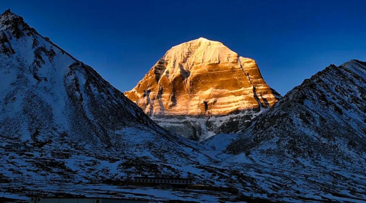
Lipulekh Pass is most widely known to Indian pilgrims and trekkers as the primary Indian land route for the Kailash Mansarovar Yatra — the sacred pilgrimage to Mount Kailash and Lake Mansarovar in Tibet. This association is not recent: the Kailash Mansarovar Yatra has been conducted via Lipulekh since 1954, under agreements between India and China.
The Yatra Route via Lipulekh: Key Facts
- The MEA-organised Kailash Mansarovar Yatra via Lipulekh is one of two official Indian government routes — the other being via Nathu La Pass in Sikkim
- From Dharchula, pilgrims travel by road through the Byans Valley to Nabhidhang, then cross Lipulekh Pass on foot or by mule to enter Tibet
- Once in Tibet, pilgrims travel by road from Taklakot (Purang) northward to Lake Mansarovar (~4,590 m) and then to Darchen — the start of the 52 km Kailash parikrama
- The total journey from Delhi to Kailash via Lipulekh takes approximately 21 to 25 days under the MEA programme
- Lipulekh is considered the most traditional and culturally authentic Indian route to Kailash, in continuous use for over 70 years
2026 Yatra Status via Lipulekh
On April 30, 2026, India's Ministry of External Affairs announced the resumption of the Kailash Mansarovar Yatra via both Lipulekh Pass and Nathu La Pass — the first resumption after the suspension of the Yatra following the India-China Galwan Valley clashes of 2020 and the COVID-19 pandemic. The 2026 Yatra is planned for 500 Indian pilgrims travelling in batches of 50, between June and August 2026. Online registrations opened with May 19, 2026 set as the initial deadline. This resumption follows the restoration of diplomatic normalcy between India and China in August 2025, after the two countries agreed to reopen the Lipulekh route for bilateral trade — a development that itself triggered fresh diplomatic protests from Nepal.
Conclusion
Lipulekh Pass is many things simultaneously — a sacred gateway for pilgrims, a strategic military position, a historical trade corridor, a geopolitical flashpoint, and one of the most dramatic crossings in the entire Himalayan range. Its altitude, its location at the India-China-Nepal trijunction, and its role as India's oldest overland route to Kailash Mansarovar give it a significance that goes far beyond any single category. For the pilgrim, Lipulekh is the moment of crossing — the point where India ends and the sacred Tibetan plateau begins, where the long journey from the plains finally gives way to the mountain that defines the journey's purpose. For the traveller, it is one of the most extraordinary high-altitude landscapes on earth. And for anyone trying to understand the complex realities of India's Himalayan borders — Lipulekh is the place where history, geography, spirituality, and geopolitics converge in a single 17,000-foot mountain pass.